Final diploma project at The Oslo School of Architecture and Design, spring 2020.
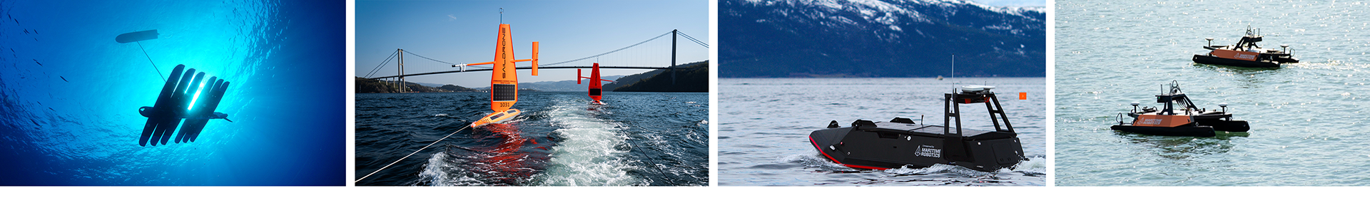
Maritime industries are complex workplaces where human and environmental safety is critical. Innovations in the field of Artificial Intelligence, wireless technology and robotics are enabling new ways to perform dangerous or repetitive tasks at sea without having people onboard. Small Unmanned Surface Vehicles (USV) can carry sensors in ways that before have been too expensive or risky with traditional methods and offer great advantages in data collection from our oceans. Gathering of knowledge and data over long periods of time is key to understanding our oceans and for a sustainable future.
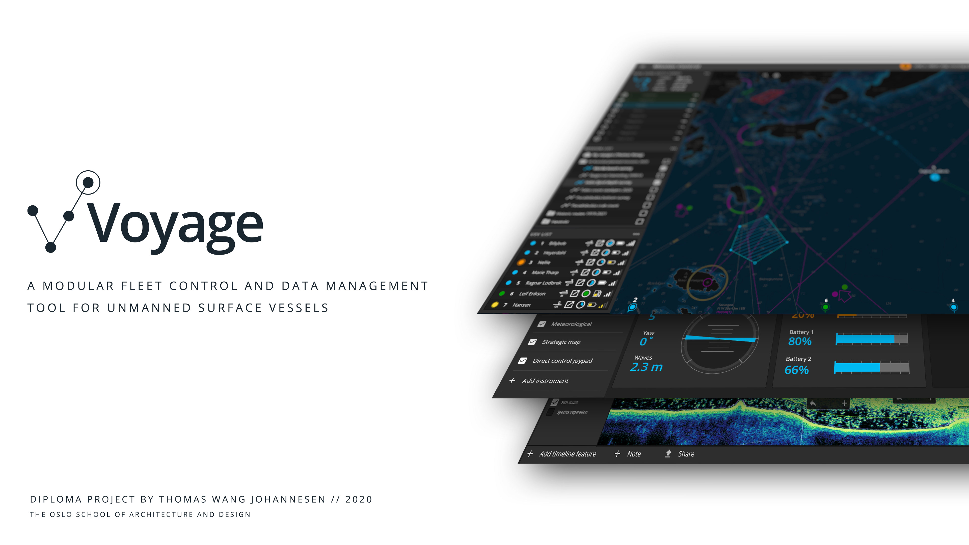
Through research, field studies with Lostjenesten, interviews with marine researchers and Vessel Traffic Services operators, mapping and prototyping, I have explored and developed a proposal for a modular fleet control and data management tool for Unmanned Surface Vessels. In other words; a software for operators and marine researchers to plan and execute unmanned missions at sea, as well as tools for analysis and sharing of the ocean data collected. The software is modular and could be used in a multiscreen setup at a fixed shore control centre, onboard a mother ship or as a scaled down mobile version for field surveys.
My work is building on the OpenBridge design guidelines, developed at the Ocean Industries Concept Lab, at AHO.
Download the digital report here: Voyage - Digital Report
Scope & Use case study
Autonomous maritime systems is a field which is in constant development, from large industry actors, to DIY and research projects. I chose to scope my project to smaller Unmanned Surface Vessels (USVs).
In areas like ocean mapping, research and routine tasks like data collection, fleets of smaller autonomous vessels can really make a difference:
In areas like ocean mapping, research and routine tasks like data collection, fleets of smaller autonomous vessels can really make a difference:
"Unmanned surface vessels could perform 10 times the amount of research missions at 1/10 of the price"
- Asgeir Sørensen - Amos (Centre for Autonomous Marine Operations and Systems)
- Asgeir Sørensen - Amos (Centre for Autonomous Marine Operations and Systems)
A solution like this is part of tomorrow’s data collection. It is cheap, sustainable and scalable. The raw data is too big to be sent home by satel- lite. But if the vessels have an onboard AI system, that can interpret what they see, they could send the results back in realtime.
- Ronald Pedersen (Havforskningsinstituttet)
- Ronald Pedersen (Havforskningsinstituttet)
To have automated processes, data collection and more effective routine missions is time and cost saving, and for much of the data collection to be as objective as possible.
- Sigurd Heiberg (Havforskningsinstituttet)
- Sigurd Heiberg (Havforskningsinstituttet)
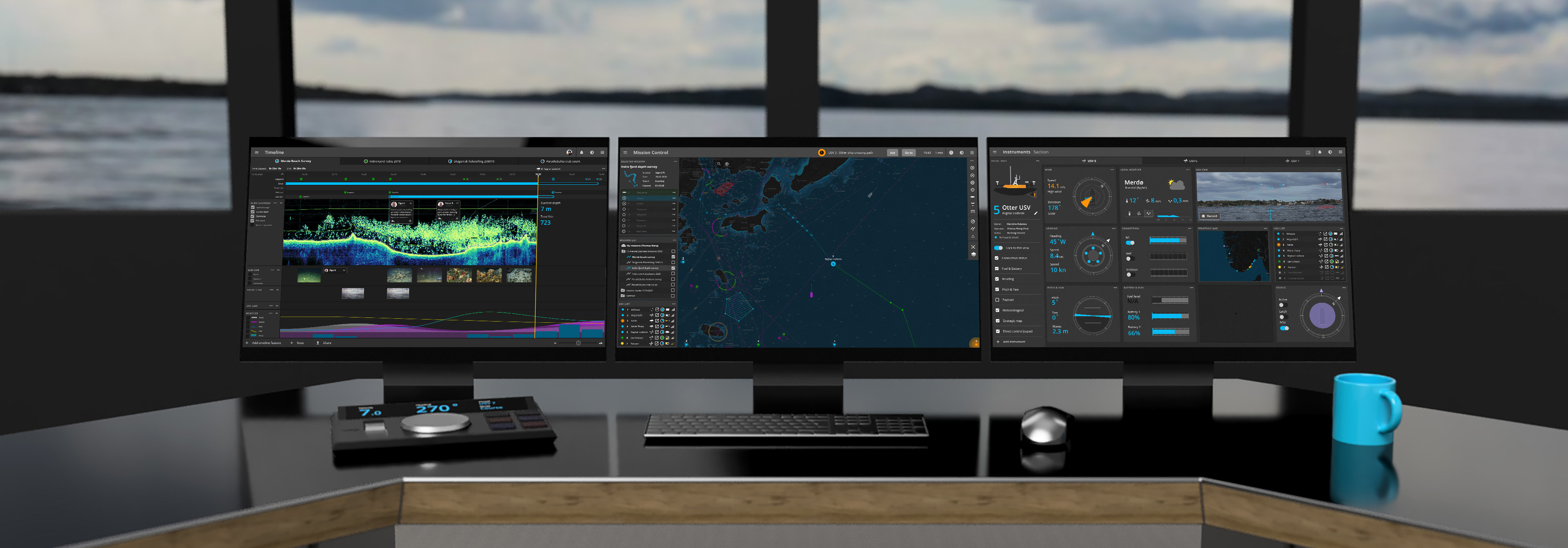
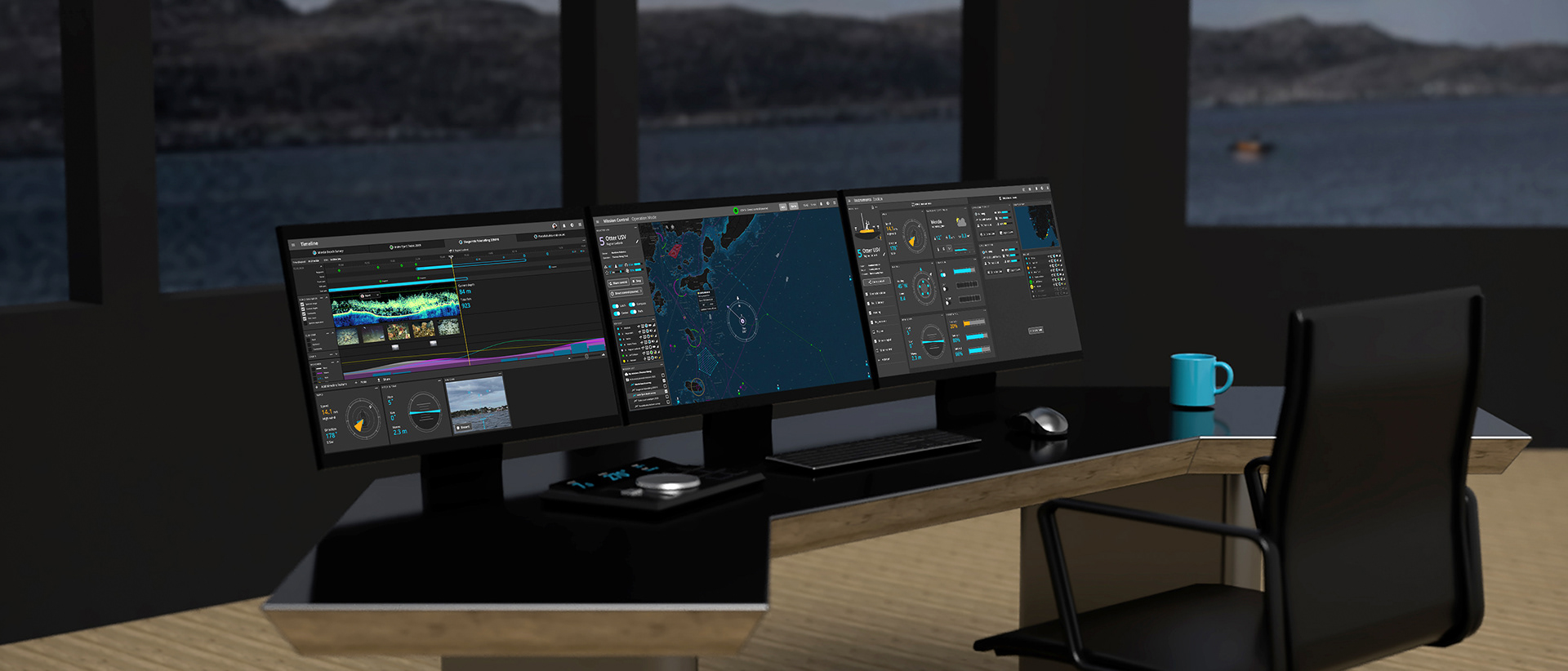
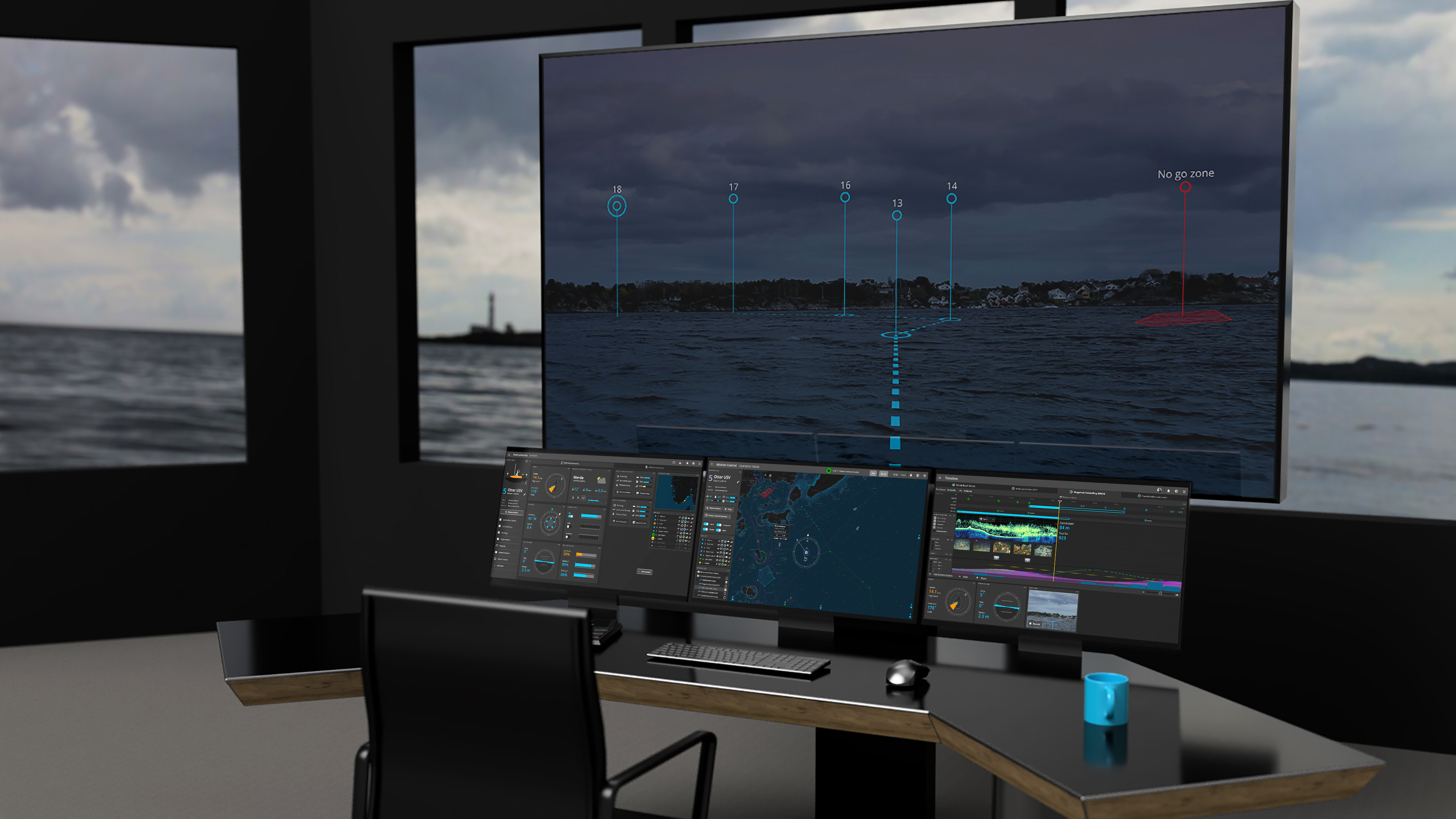
Suggestion for a Shore Control Centre with 4 screens:
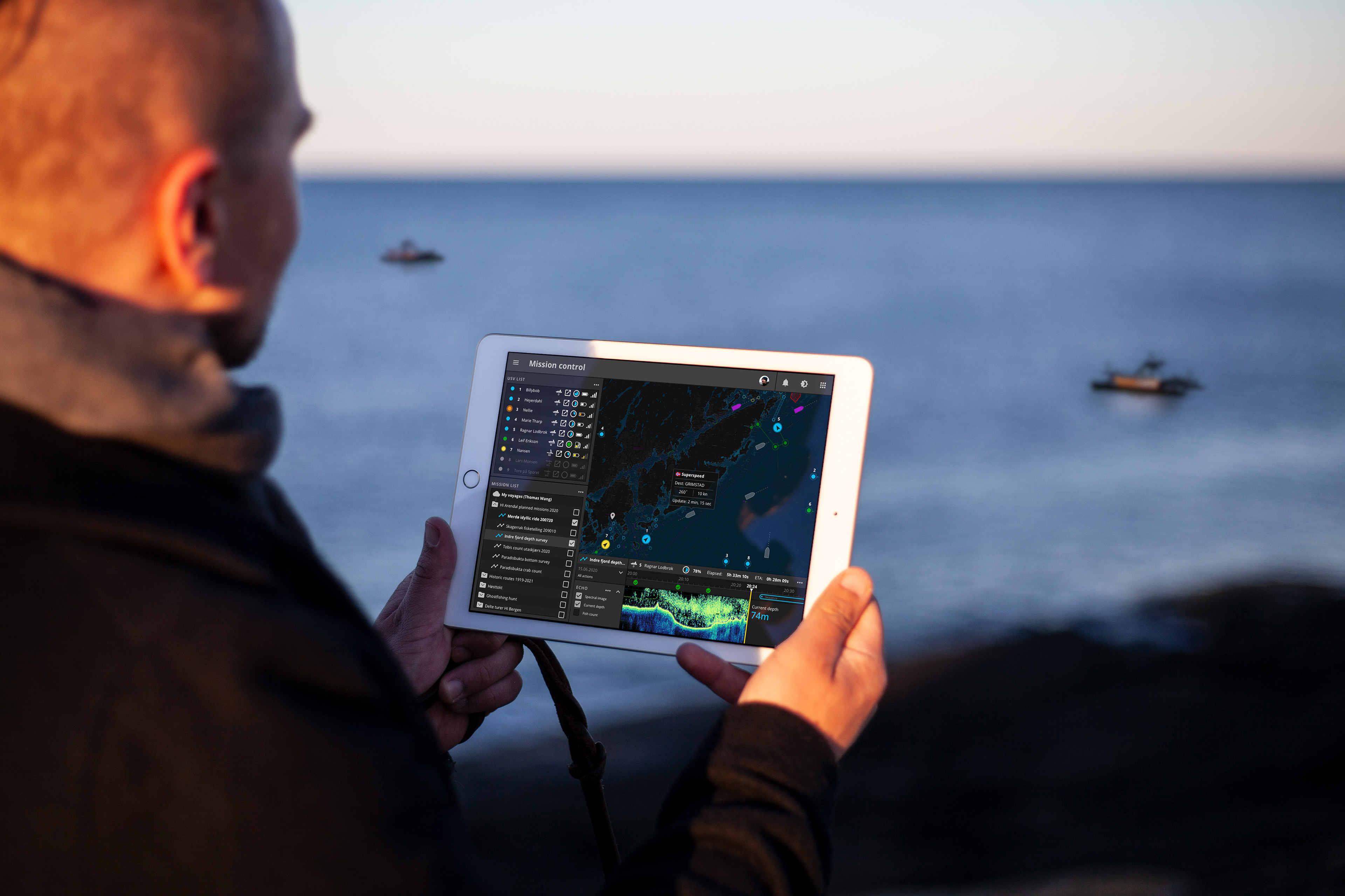
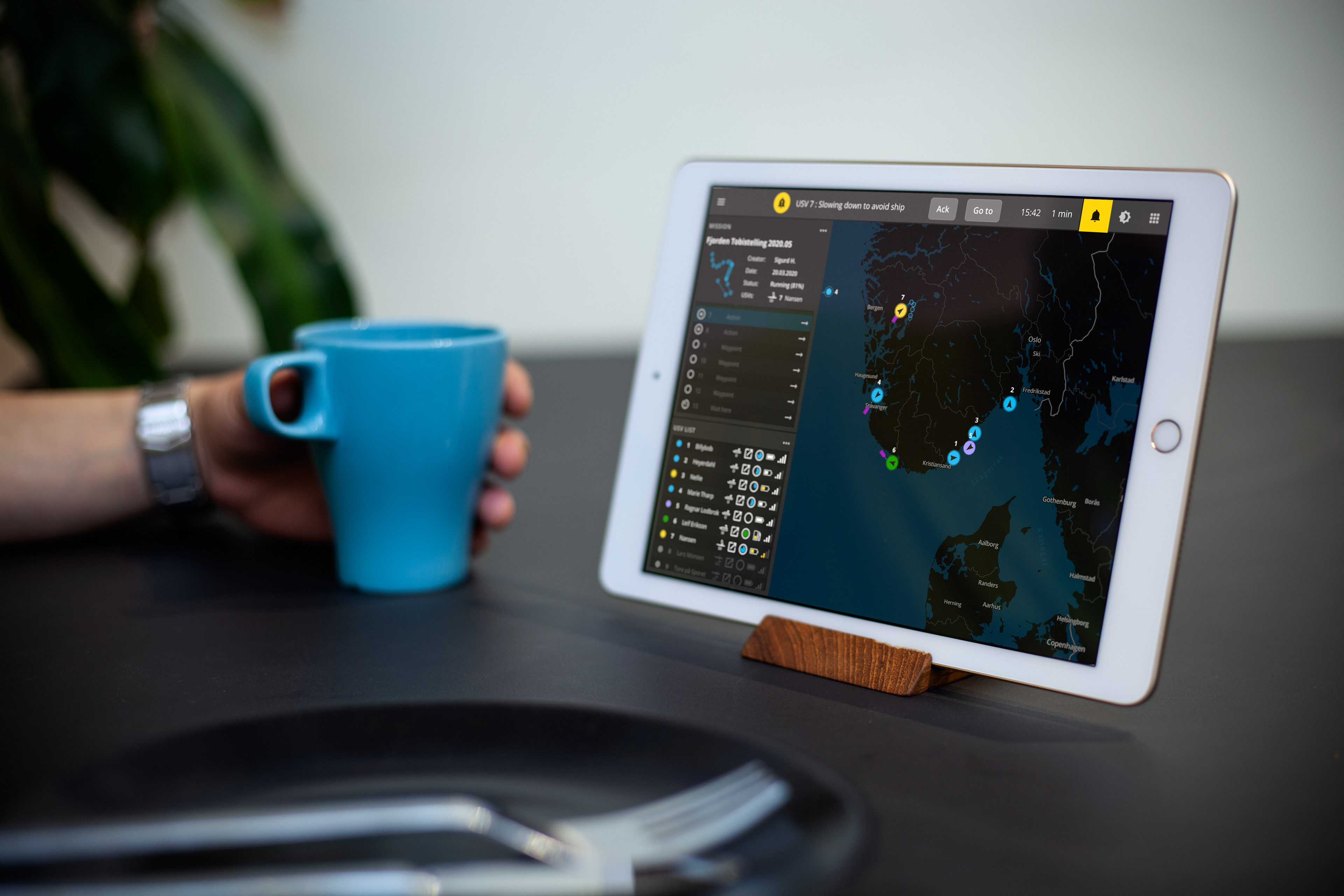
Sustain situation awareness while being mobile away from the office:
Workstations onboard a mother ship bridge:
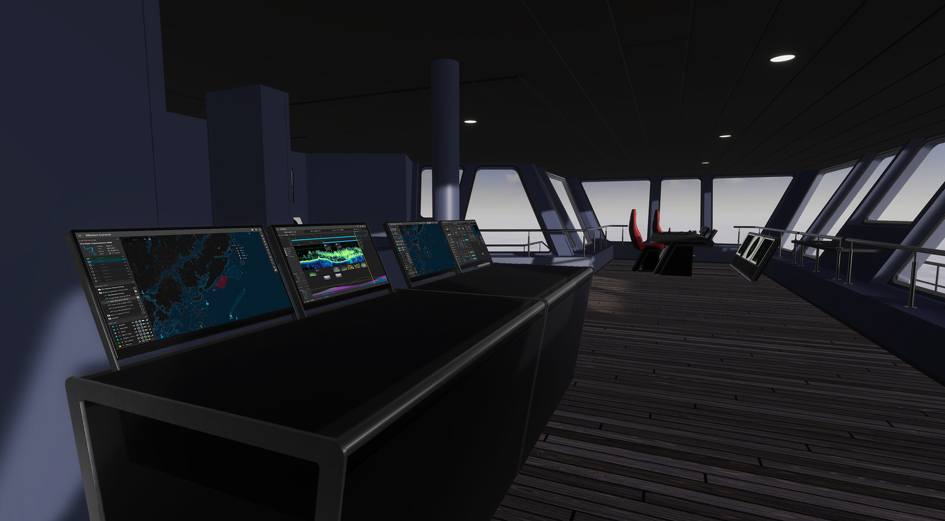
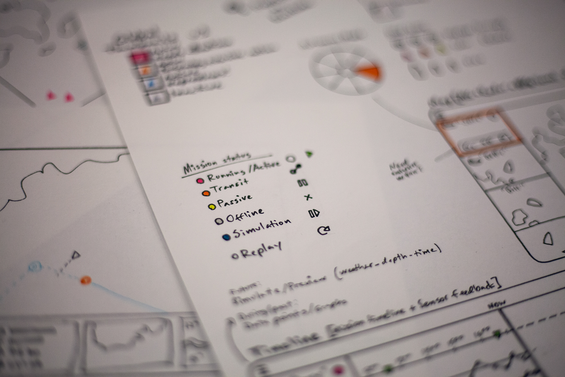
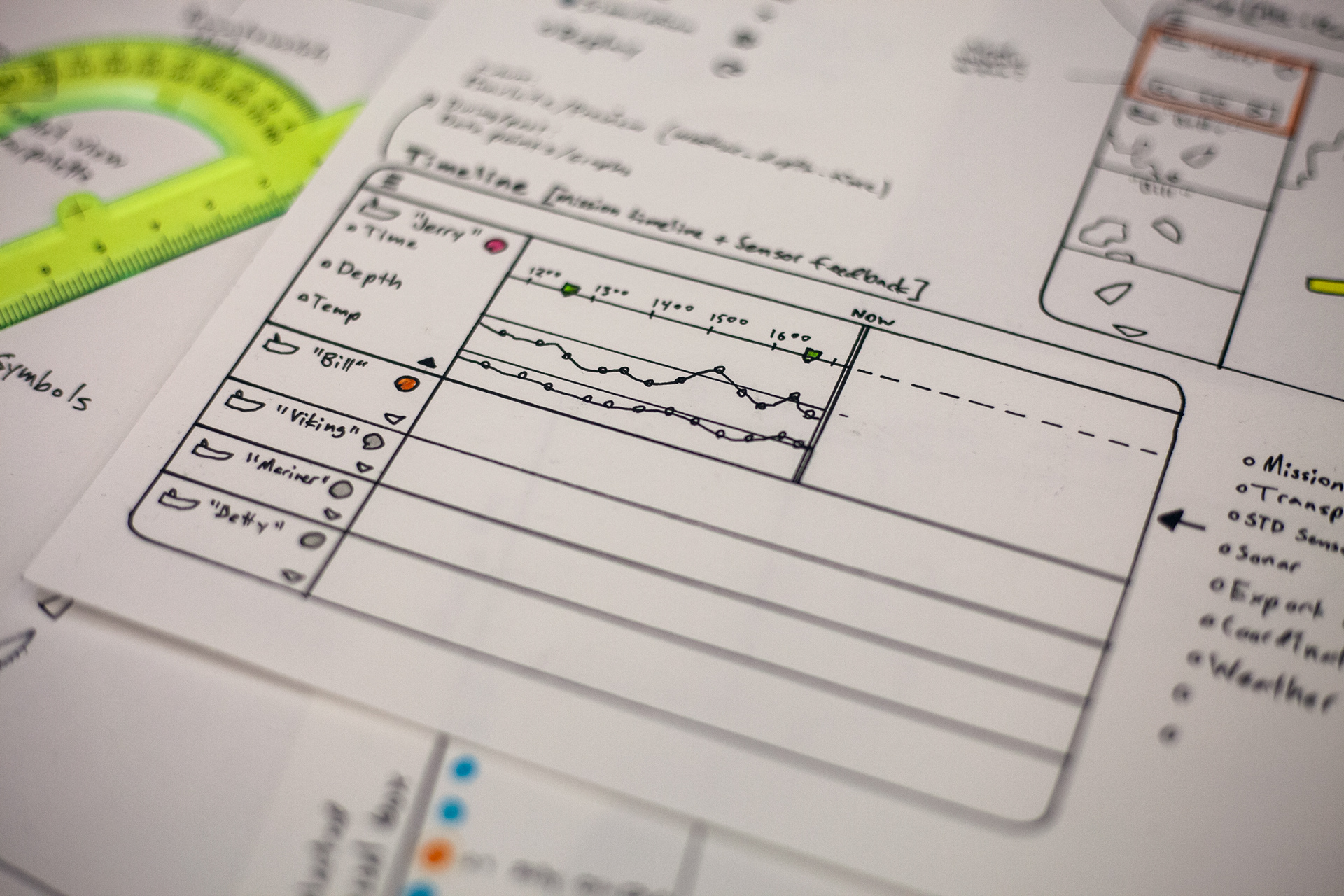
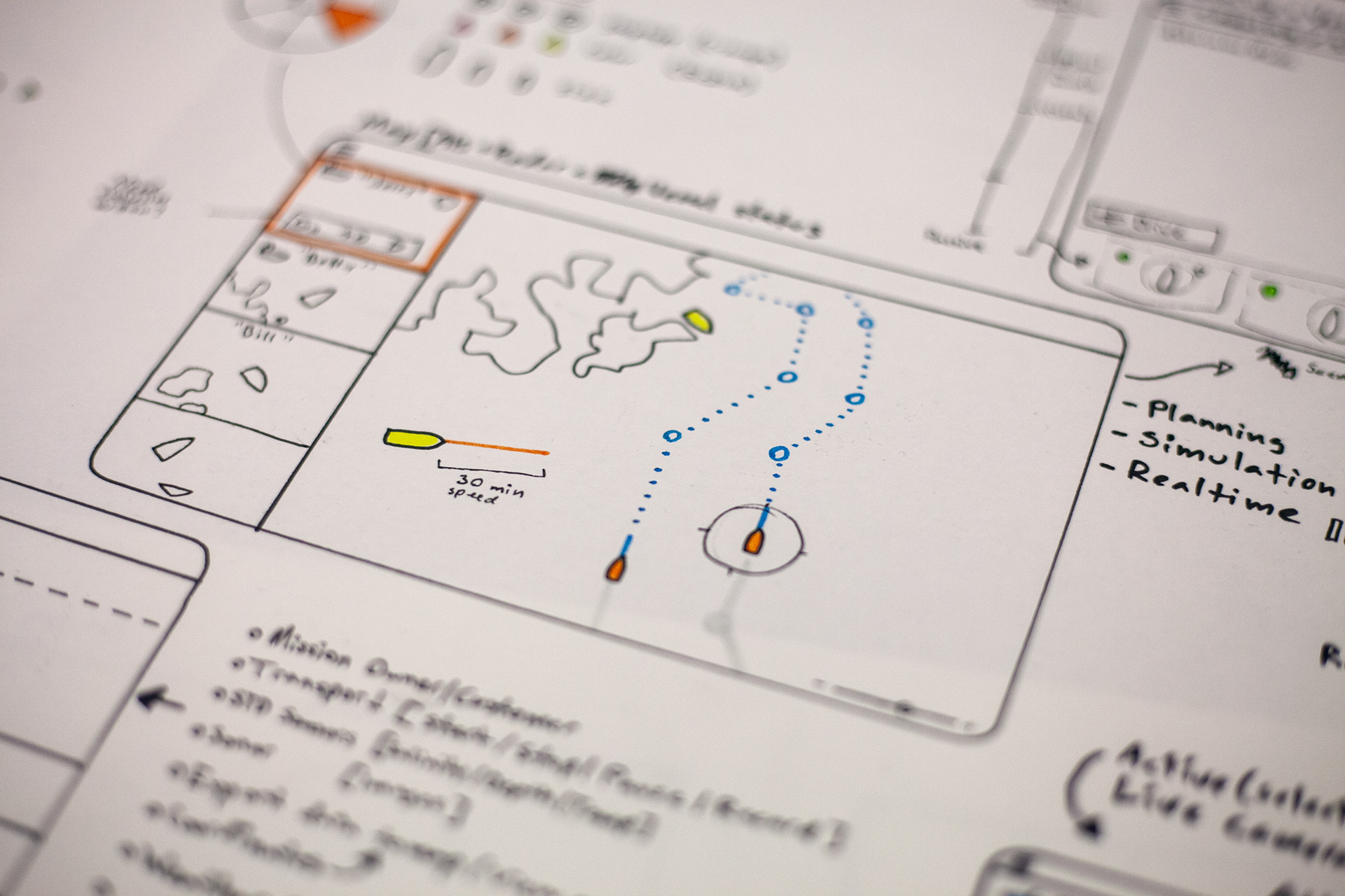
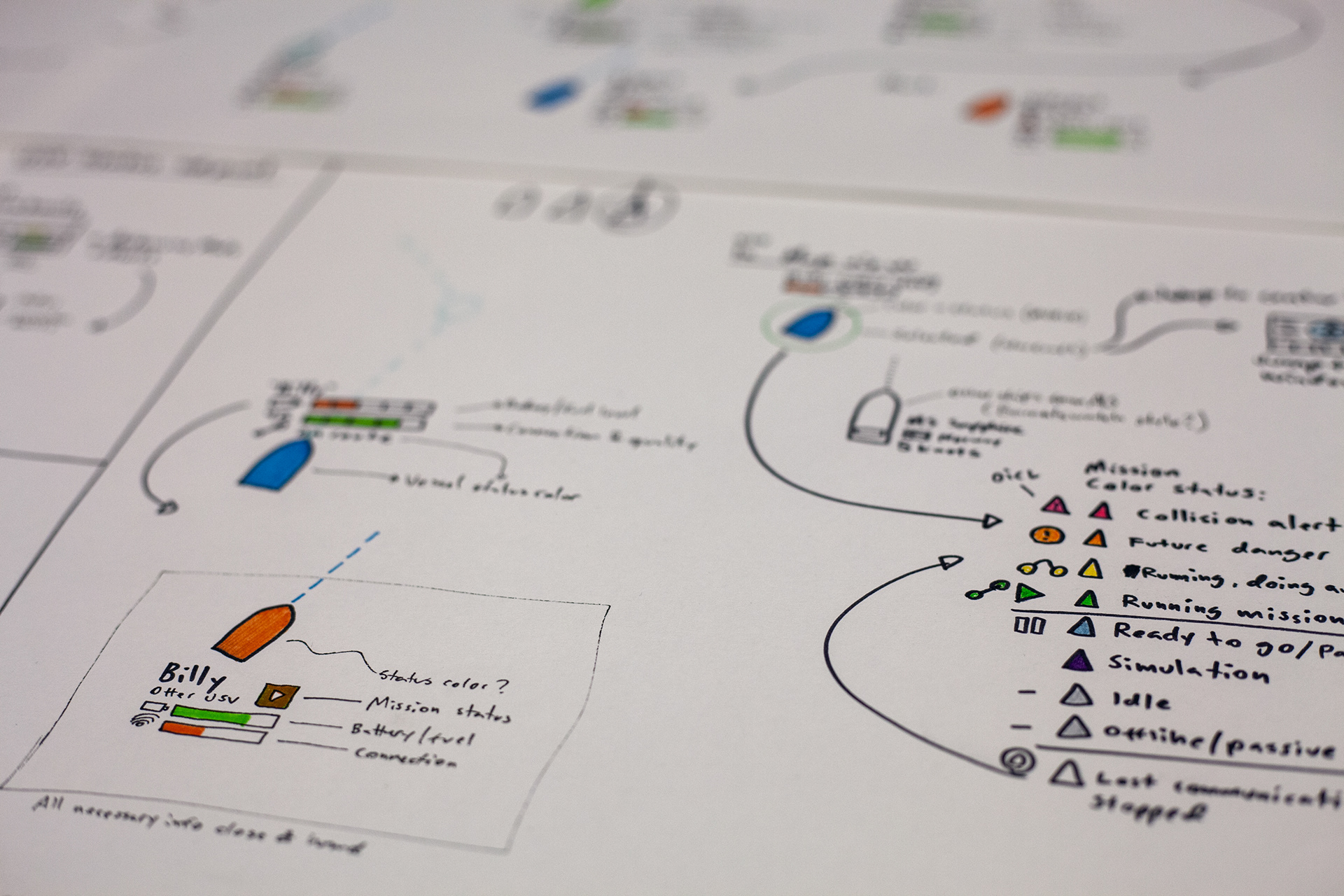
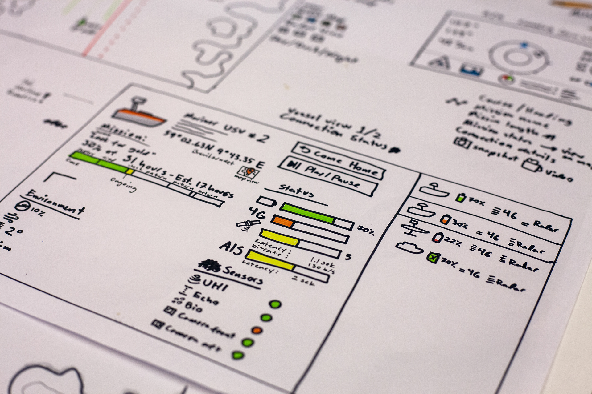
Main sections of the system: Timeline / Mission Control / Instruments
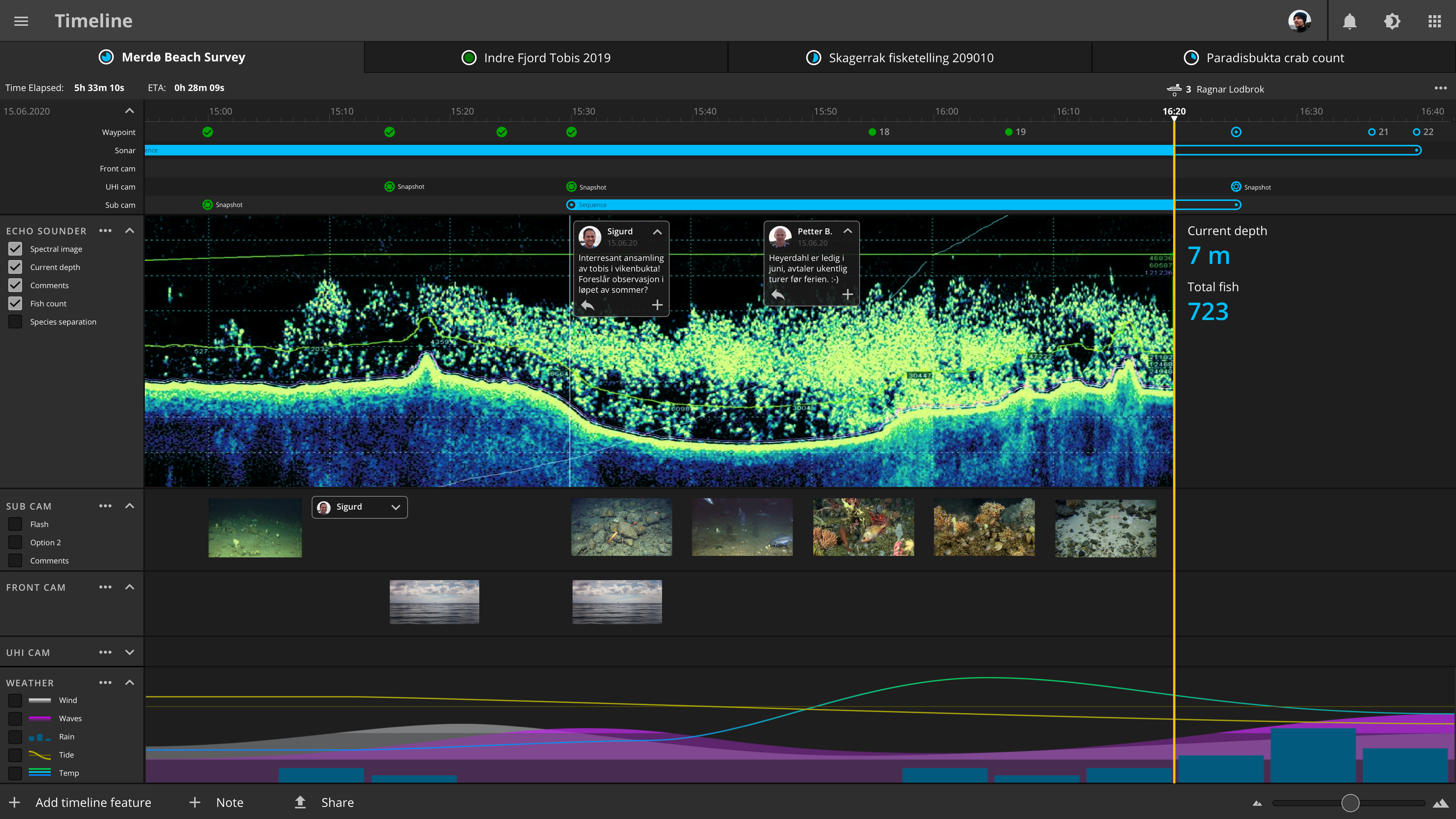
Timeline section for mission data collection and sharing
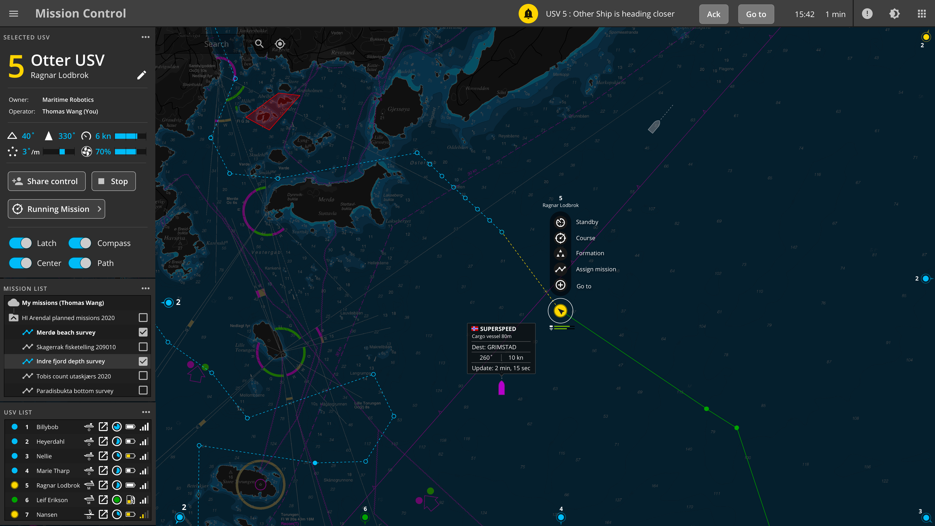
Mission Control for planning and spatial overview
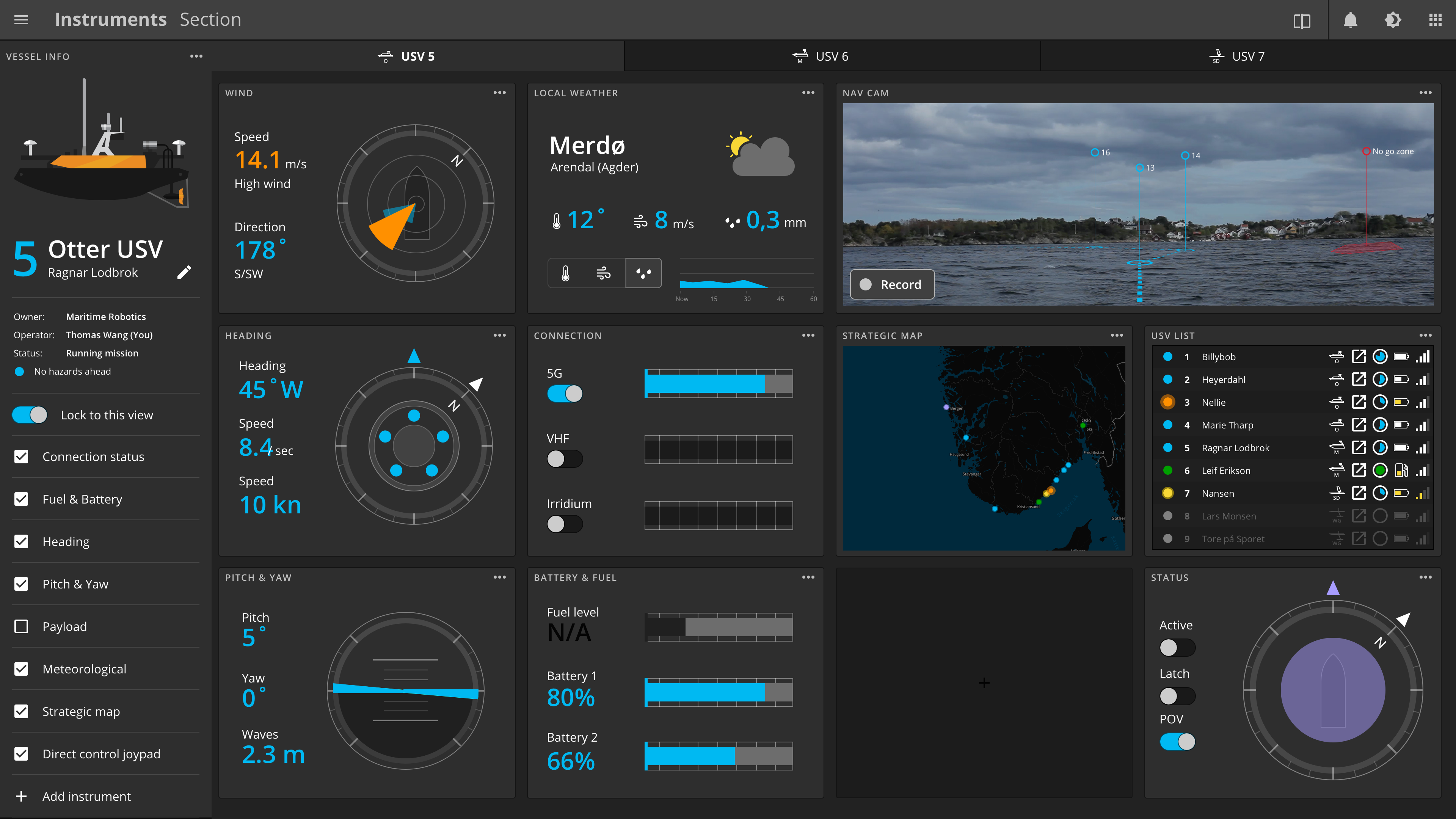
Instrument section for detailed live information on each USV
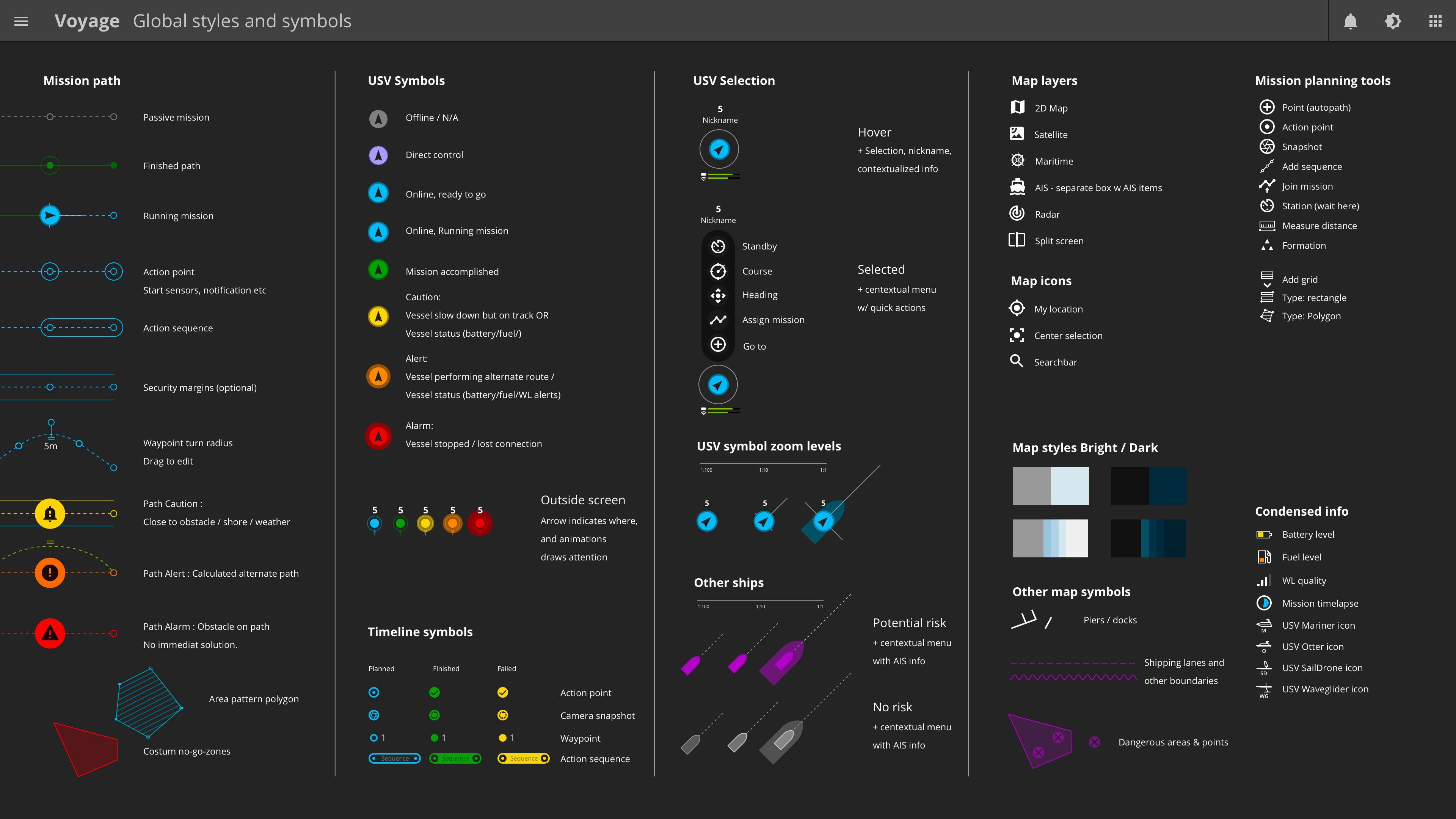
Global styles and symbols:
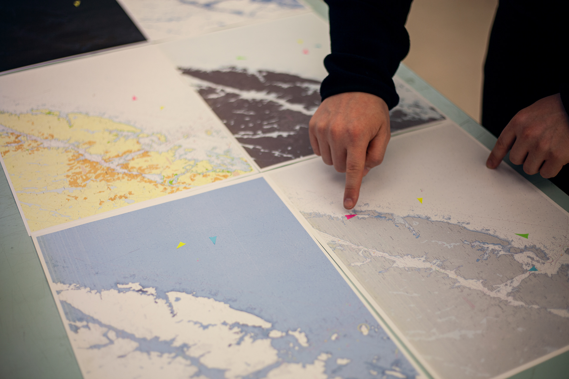
Maritime maps
Tried and tested static maritime maps have a clear distinction between land and water, difference in water depth contours, and information useful when navigating at sea. Problems arise when there is a need to display additional dynamic information on top of these maps like routes, ships, warnings and UI elements. By adjusting the available colours in Kartverkets maritime maps I could explore variations in more subtle palettes suitable for displaying an additional layer of information as well as variations for the day and dusk mode:
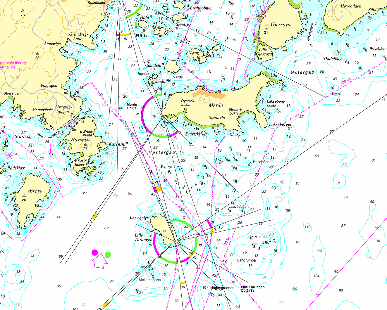
Original maritime map from Kartverket
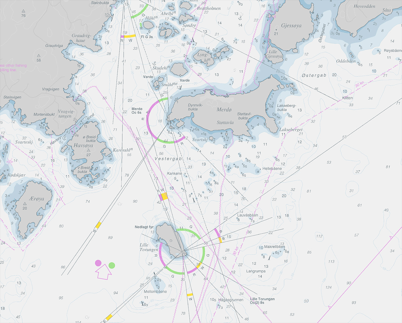
Edited map for a bright palette
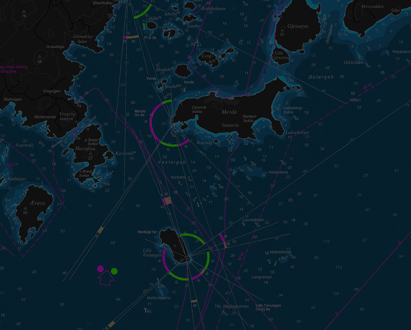
Edited map for Dark palette
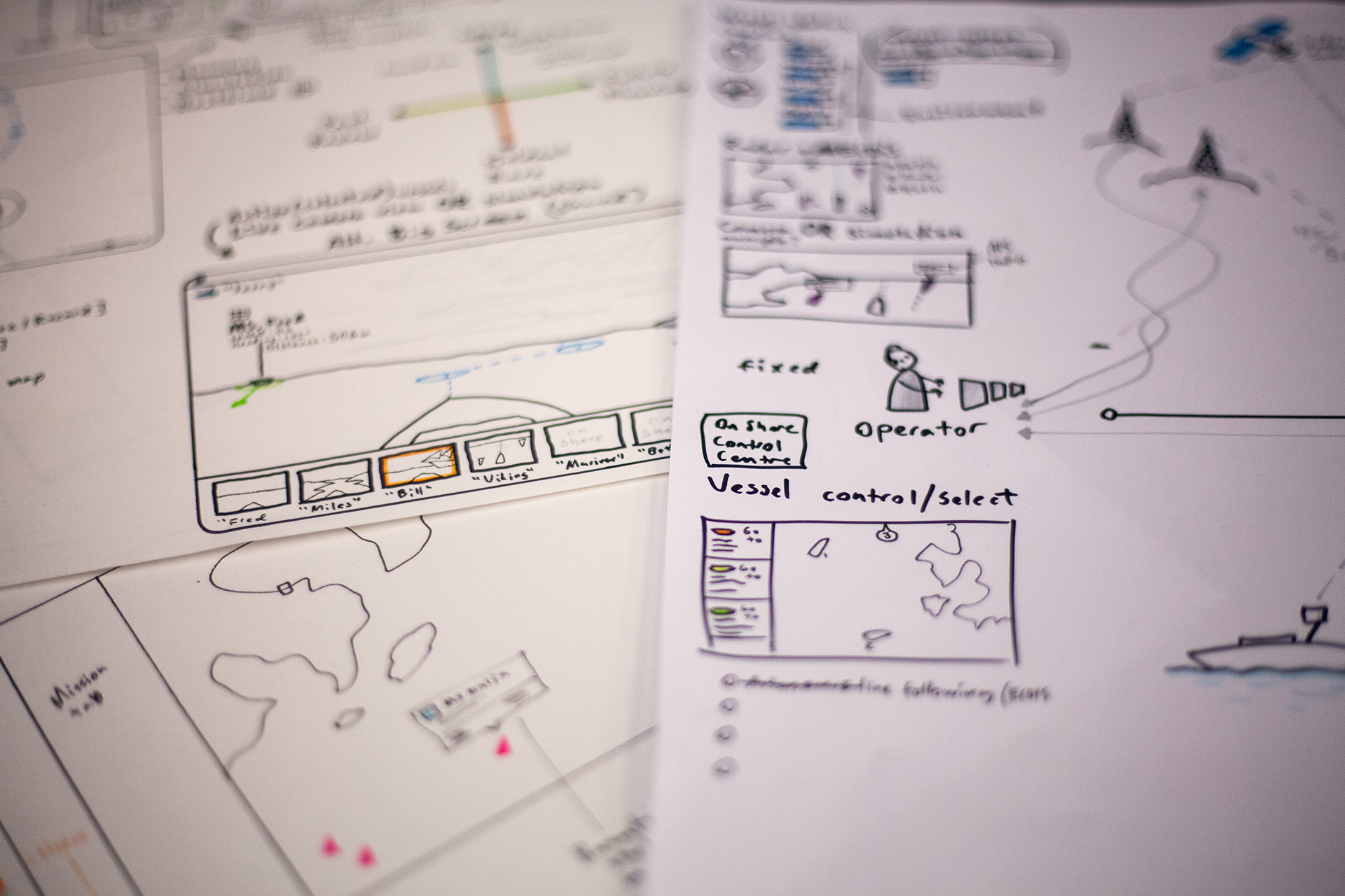
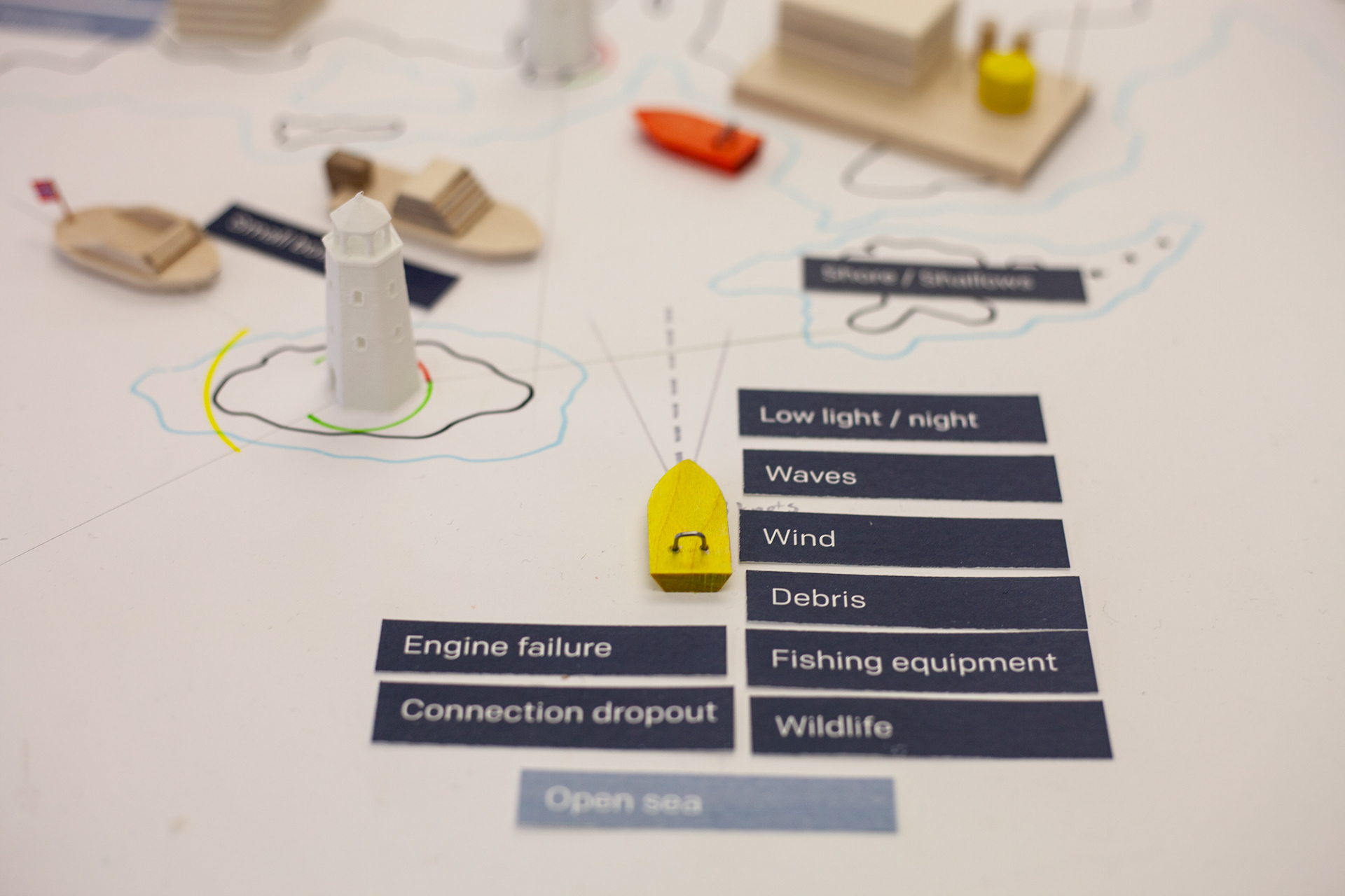
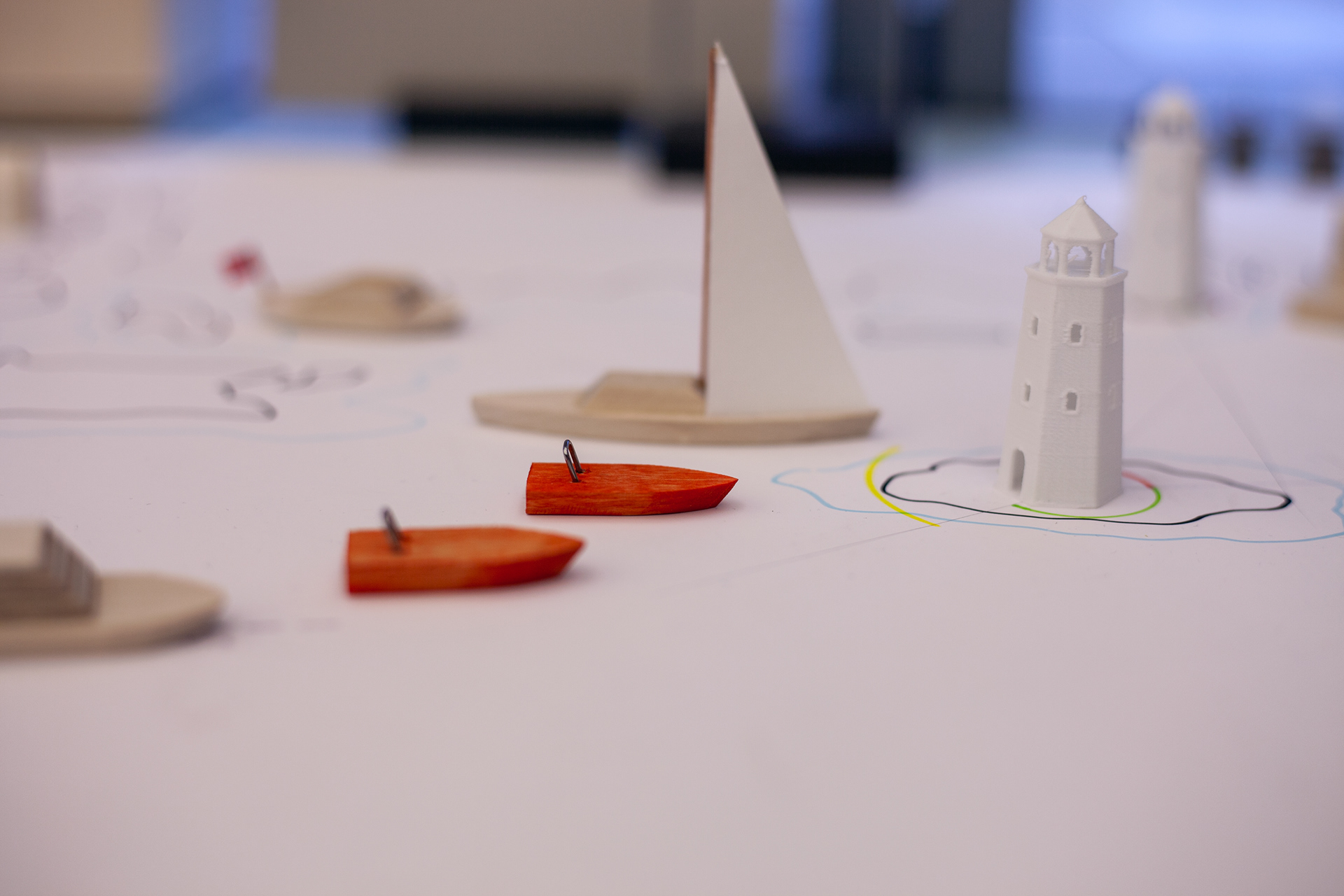
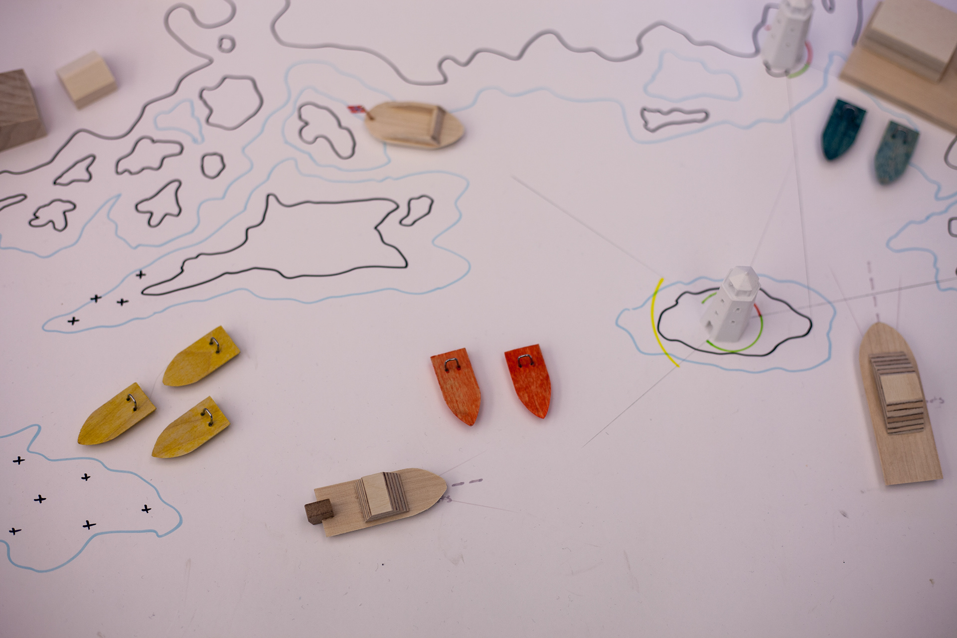
Early paper sketches and models for exploring scenarios:
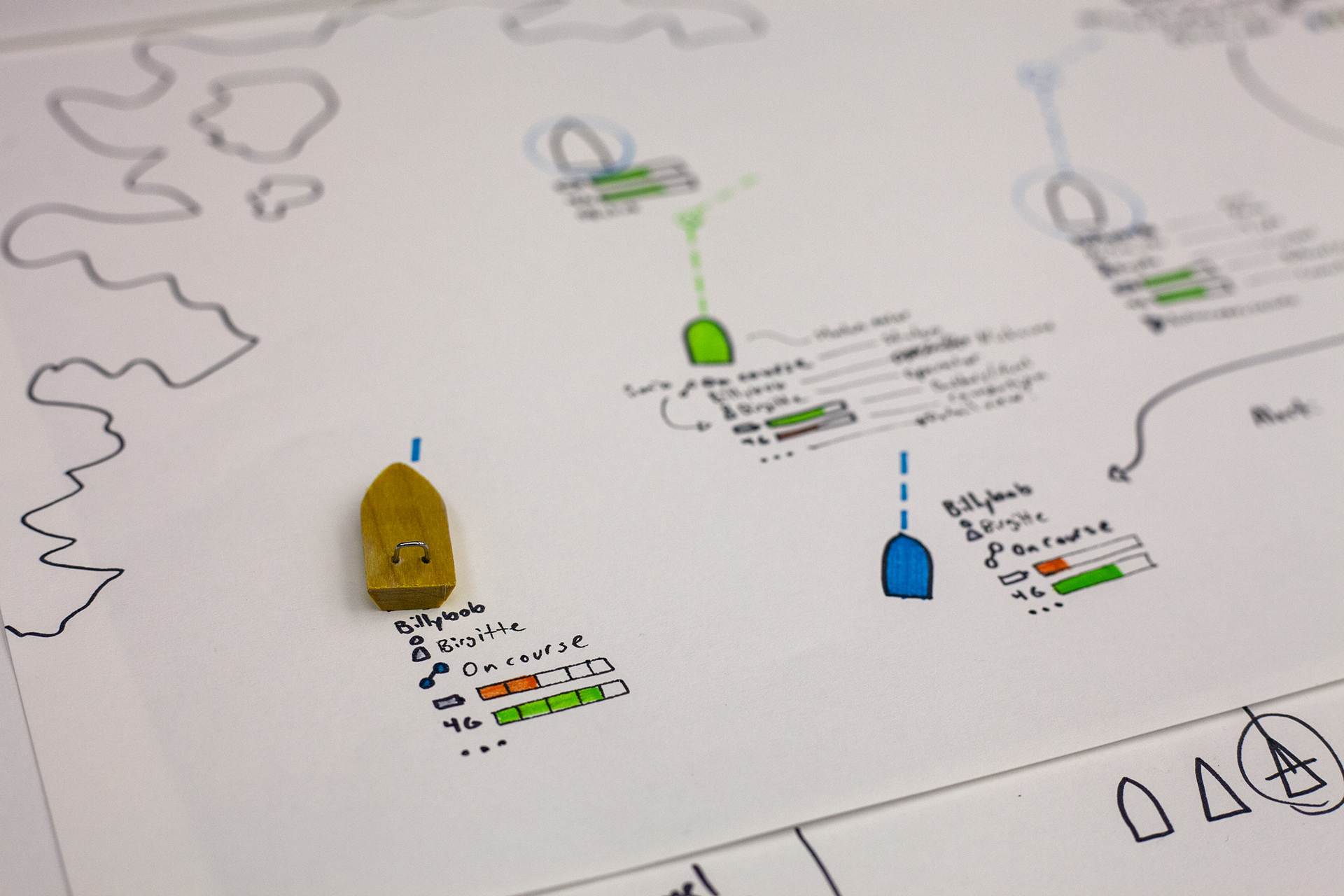

Feedback from sensor:
Designing the user interface of the remote control of unmanned vessels to be used in marine research is a highly complex task. To be able to come up with relevant designs, you need domain knowledge and technical insight; You must have a sufficient level of understanding of maritime rules and regulations, navigation, maritime technical equipment, and the technology involved in autonomous operations. You also have to understand the marine operations the vessels take part in, as well as the needs of the vessel operators and the marine researchers. Taking on such a huge task with no prior experience in designing for the maritime domain is a risky diploma project. However, Thomas proved that he was able to handle this complexity in an exemplary way.
Through his diploma project Thomas shows excellent interaction design skills and professionality. He demonstrates an ability to take on a complex design project and not be lost in complexity, but rather learn just enough of all the parts of this complexity to create high-quality designs that are “explorative but feasible”, as he aimed for. The quality and amount of work Thomas carried out in his diploma project is impressive, particularly in the light of the current corona crisis. Congratulations Thomas!
- MSc Industrial Design Engineering, PhD Sigrun Lurås